


Quick Adventure Facts:
Who - Joe (see gear list) & Matt (see gear list)
What - The Great Outdoors Challenge
When - May 10th to May 22nd 2019 | 13 Days
Where - Mallaig to Aberdeen, Scotland | map, .gpx, .kml *
Trail Overview
Trail
The Great Outdoors Challenge isn’t a set trail but rather an event hosted by The Great Outdoors Magazine each year. It is a challenge, not a race, which involves crossing from the west coast of Scotland to the east coast on foot during a specific two week window.
Participation is limited to around 250-300 challengers each year.
LengthTGOC is a really unique event in that there is no defined route. There are many possible starting and end points. Challengers must create their own path on existing trails, jeep roads, and cross country through the Scottish highlands.
Scotland is a wide open country with few trees, so you can walk almost anywhere. You can even walk across private property legally in Scotland. The only limitation is your route must be vetted and approved to make sure it is safe and realistic. Practically no two routes are exactly the same, but you will still cross paths with many other challengers along the way.
The average route length is around 200 miles.
TerrainAs there is no set trail, there are no markers and you’ll have to follow your maps and GPS to make sure you’re on track. Most routes are a mix of trails, dirt roads, and cross country routes. The landscape is wide open with grass, soft shrubs, and 'peat hags' which are like muddy pits where the soft ground has eroded away.
The cross country sections allow you to walk almost anywhere you’d like frequency passing a fair amount of ruins, castles, and other historical landmarks including places like Loch Ness, Balmoral Castle and Fort William.
The ground is very wet and squishy most of the time. A fellow challenger suggested that “Scotland is not a country, but rather a giant sponge floating in the North Sea.”
WeatherMay in Scotland has notoriously crummy weather. A typical day might be between the 30's and 50's F, and it is often rainy or even snowy. Challengers should expect to be walking in 40F rain for two weeks with night times temperatures potentially dropping below freezing.
It can be really windy on the exposed peaks, and you need to be prepared to camp in those types of conditions.
Timing
The challenge takes place during the second and third weeks of May. This particular window of time was chosen as it usually comes after the last of the severe winter weather and before the annual infestation of the dreaded Scottish midges; nasty biting flies similar to mosquitoes.
Most of Scotland is sparsely populated and many of the starting and ending points are in fairly remote areas. Luckily, the train system in Scotland, as in the rest of the UK, is pretty awesome. Sometimes the train will stop at a bench in the middle of farmland to drop off or pick up a passenger.
The hardest part of TGOC is probably planning it. Since you have to create your own route it takes a fair amount of time pouring over maps, Google Earth, and prior year challenger's blogs. Planning your foul weather alternatives can prove to be the most difficult challenge for a lot participants.
Navigating can prove to be tricky as well as there are many times where you will find yourself hiking in dense fog with no ability to pick out landmarks. A GPS or navigation app on your phone can prove to be invaluable.
ResupplyDesigning your own route affords Challengers the ability to resupply as frequently as they’d like. Some routes stay low in valleys and can pass through villages every day. Other routes can venture through more remote areas with resupply taking place only once or twice per challenge. One of the best parts of the adventure is visiting quaint towns, and socializing with other challengers at the local pub or hostel.
GearA typical 3 season set up like Joe and Matt used will work well on for TGOC, maybe with some gear rain gear thrown in. You can check out Joe's gear list here and Matt's here.
Trip Report
By: Matthew Favero
When Joe, Steve and I finished our first TGO Challenge in 2014, we immediately agreed that we would come back and do it again in 5 years. We penciled it in on the calendar and I slowly set out to imagine our next route. The trip was so much fun that we decided to invite some more friends along for the next go around.
Technically, you’re limited to a group size of 4. We decided that we’d recruit another 5 people and have two groups of 4 that had similar routes that met up here and there but which were entirely unique in their own right. Joe, Steve and I needed one more for our group and then we had to assemble a whole new group.
With more than a full year to go before the event, we decided to reach out to our long time friend Plug-It In, our buddy Blaze Blind (aka BB Giggles) and three customers whom we had built a great relationship with; Darwin, Bigfoot and The Blackalachian. Logistically, this is a tough hike to plan and commit to but we were thrilled that everyone was able to accept our invitation. Now that we had our groups locked in, I set out planning our route.
To make things interesting, we decided to design the route around the goal of summiting the 5 highest peaks in the Scotland. It just so happens that those are also the 5 highest peaks in all of the UK. The highest peak in Scotland, Ben Nevis, is nowhere near the next highest 4. This logistical obstacle would required us to get a little “creative.”
I scoured the fantastic online maps from Ordnance Survey, used Google Earth with tons of different overlays and even used Google Maps a bit to piece together what looked like an amazing route. We would start in the small fishing village of Mallaig on the west coast before making our way through the highlands and finishing in Aberdeen on the east coast. The route would be roughly 220 miles, take us over the 5 highest peaks and give us just enough time to resupply in the small villages of Scotland’s interior.
Meeting up in Glasglow was a fun exercise in travel and logistics. Plug-It In and Darwin flew into Florida a day early and we all flew on the same plane to Newark. There we met up with Steve who flew in from Atlanta, Joe who flew in from Syracuse and Bigfoot who flew in from Minneapolis. We then all boarded an overnight flight to Glasgow.
When we landed in Scotland, the airport had a place where we could combine all of our street clothes, throw them in a bag and send them to the hotel at the end. We then caught a bus to the train station and met up with The Blackalachian who had flown into London a few days earlier before taking the train to Glasgow.
Once we were all together, we headed out to buy some fuel from a camp store and stock up on food for the first leg of the trip. We walked around town for a while before making our way to the train station to catch the train to Mallaig.
When we arrived at the train station, we ran into quite a few Challengers; some of which Joe, Steve and I had met while on our first crossing. When our train was finally ready to board, it quickly filled up with Challengers. We were surprised to see so many Challengers on the train as the first time we did the Challenge we only ran into one.
As most train rides in Scotland are, ours was filled will beautiful scenery. Rolling hills gave way to distant peaks which slowly became larger and increasing covered with snow. The sounds of the train’s wheels against the track and the rhythmic “da da…da da” lulled most of us to sleep for a decent portion of the ride.
Once in Mallaig, we checked into our hostel and then went our for a bite to eat. When we walked into the restaurant, we ran into some of Challengers (and long time customers) who we met on the train. Empty pint glasses gradually filled the table and everyone even tried some haggis; an unofficial requirement for anyone who visits Scotland. After dinner we headed back to the hostel to get some rest before our first day of the Challenge.
In the morning we had a quick breakfast at the cafe downstairs before heading to the hotel to officially sign in. Of course it was raining. It wouldn’t have been right if it wasn’t. After signing in, we headed back down to the sea to dip our toes in, took a picture and then we were on our way.
We decided it would be easier to just stick together on one route and it didn’t take long before that route us up and into the highlands. The ground was soft and moist as we climbed up and to mountains provided our first views. We could see a lake (loch in Scotland) in the distance as the trail contoured around each peak, slowly making its way to higher elevations.
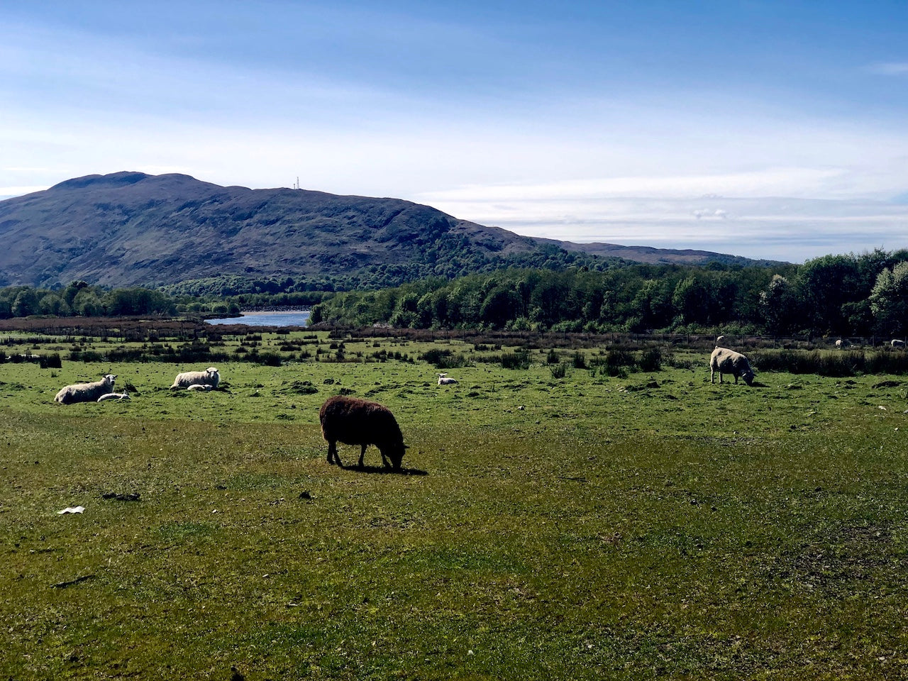
The rain slowly subsided and the sun came out. The sun was a welcome appearance and our route lead us past some beautiful high elevation lochs. Sheep began to appear with regularity and with every bit of climbing came even more expansive views of the mountains around us and the lakes in the valley.
Soon we had a choice to make. We dropped down to Glen Tarbet and could follow along a steep trail on the side the lake, go up high and then drop down at the end of the lake or just go up high and extend the day much farther. We took a vote and decided to follow the lake.
We hopped a fence and began following an overgrown trail through a forest before popping out a few hundred feet above the lake. The trail was almost none existent in parts and nothing more than a series of interweaved sheep trails in others. The hiking was a little slow going and our paced slowed.
Joe, Steve, Darwin, Bigfoot and The Blackalachian all made it to the head of the lake first and set up camp. As Plug-It In, Blaze Blind and myself got closer to the end of the lake we could see a bothy (an old house transformed into a shelter for backcountry walkers) on the other side. It even had smoke gently billowing out of the chimney. We decided to push ahead the extra mile or so to spend the night indoors.
The bothy was probably only three-quarters of a mile, as the crow files, from where we were and the route didn’t look too difficult. We’d just have to cross a small river, climb over a small hill, cross another small river and then we’d be there.
We set out and crossed the small river with ease. The climb up the hill was straight forward and pretty relaxed. Once we made it to the top though, there was a shear, rocky, drop off on the other side. We searched for the best place to drop back down but there weren’t very many options.
Eventually, we found a spot were we could slide down some rocks and hold onto the trunk of a small tree growing sideways out of the mountain to get down. I threw my trekking poles down and precariously descended. It was a little sketchy but we all made it.
We crossed the river and made it to the Oban Bothy at around 9:50pm; just as the last bit of sunlight started to disappear. We had hiked for almost 13 hours on the very first day and the last three-quarters of a mile took almost an entire hour.
We opened the door to the bothy, said hello to the lone inhabitant; a Brit named Paul and then went upstairs to get our sleeping pads and sleeping bags set up. We went back down stairs for a bit to hang our wet socks in front of the fireplace before eating dinner and turning in for the night.
We woke up early the next morning and waited for the others to join us. As we had made the mistake of taking a low route to get where we were, we guided them to take a higher line which was much less scary. They quickly made their way to our position and we started hiking up the valley together.
We hiked for less than a half an hour before coming upon a decent little climb. The climb led us to the top of a fairly low pass and soon we found ourselves in another boggy valley, following a river as it slowly meandered to the east. The river dumped into a lake and the trail followed an extremely steep hillside as it made its way to the other side of the lake.
Not long after we passed the lake we came to Glenpean Bothy. We stopped and took a break and enjoyed our time out of the wind. The Blackalachian took out his stove and cooked some sausage on a stick and we just enjoyed the banter.
Once back on trail, we came to Loch Arkaig. We followed a quiet road on the northern shore for miles and miles. We were making good time and we passed our designated camp spot for the night. Eventually, we found an abandoned caravan lot right along the lake. We set up our tents and hung out for while before heading to bed.
In the morning, our route continued along the shore of the lake before turning south at the eastern end of the lake. We passed an old castle location at Achnacarry before briefly following a road alongside of Loch Lochy until we came to the Caledonian Canal. We crossed the canal on a lock and then followed the tow path south to Caol.
We took the opportunity to resupply in Caol before continuing on. We were head to the Ben Nevis and Bunkhouse for the evening and our route would take us past Old Iverlochy Castle before walking through the out skirts of Fort William and into Glen Nevis.
The road narrowed as we made our way into the Glen and my feet began to throb. The entirety of the day had been on pavement or hard packed gravel roads and my feet had taken a beating. I hobbled into the inn, checked in and went down stairs to rest. I tried to take a nap before dinner but the bunkhouse was too noisy and I mainly just laid there.
Joe had made dinner reservations at 6 and we all made our way upstairs to eat. The restaurant was an old converted barn and the atmosphere was rustic and quaint. The food was delicious and the company was even better. Our table, once again, filled with empty pint glasses as we shared stories from the trail and generally gave each other a hard time. After dinner, we made our way downstairs to get some sleep.
The night was pretty miserable. People were upstairs running around late into the night and I couldn’t get quality sleep. Then around 3am, I woke up from the throbbing in feet. I struggled to get down from my top bunk. My feet screamed with pain with each rung they stepped on as I made my way down.
Once I made it to the floor, I sat on the ground collecting myself before struggling to put my shoes on. I grabbed my food bag, some ibuprofen and my phone and slowly hobbled into the kitchen. I made myself some oatmeal, took some ibu, slammed a liter of water and laid down on a bench as my feet throbbed with each beating of my heart.
I was starting to get concerned as we were supposed to climb the highest peak in Scotland in the morning and I could barely walk. I’ve experience this pain before and it usually lasts for days and sometimes doesn’t go away until well after my hike has ended. I laid there, wasting time on my phone as I tried to will away the pain.
Before too long, the sun began to rise and other guests of the bunkhouse began to stir. The kitchen became a busy place and the conversations with the other adventurers slowly distracted me from the pain. I could still barely walk but my spirits were high.
When The Blackalachian made his way into the kitchen, his feet were hurting too. He had developed blisters over the course of the last two days and he was having issues just like me. I offered him some DCF repair tape to use on the blisters as that approach had worked for me multiple times in the past.
I knew I was going to be slow during the climb, so I decided to set out early and get a head start as I knew the others would catch me fairly fast. I got all of my stuff together, put on my pack and headed out. The trail was virtually empty and my only conversions were with the sheep on the side of the trail.
It didn’t take long before the pain in my feet wore off and I began to pick up speed. I soon reached the unofficial half way point of the climb, Lochan Meal An T-suidhe. We had planned to stop here and wait for Steve who would take a break and watch our packs as we submitted Ben Nevis.
Darwin and Bigfoot showed up first and just kept hiking. Plug-It In was next and he waited with me for the others. Joe kept his pack on and The Blackalachian and Blaze Blind dropped theirs off and continued on. Eventually Steve showed up, we gathered the packs in a little wind break and Steve sat down for a nap while Plug-It In and I made our way up the mountain.
The climb wasn’t too bad but it was steady. It took us around an hour to make it near the top where the snow still covered the peak. Darwin and Bigfoot passed us as they began their descent and Plug-It In and I continued up through the snow until we finally made it to the top where Joe, The Blackalachian and Blaze Blind were waiting.
The sky was crystal clear and you could see forever. They say the peak of “The Ben” has less than 10 clear days a year and we were lucky to get one. We posed for pictures at the top and shot some video before exploring the emergency shelter. Tired of the wind, we all decided to make our way back down.
Joe took off and quickly was out of site and The Blackalachian found a quicker route down. Plug-It In and I slowly descended through the constant stream of switchbacks. When we made it back to the lake, Darwin, Bigfoot and Joe were nowhere to be found. We took a quick break before continuing on.
We ran into Joe shortly after we got back on trail. This part of the route involved some cross country and we stuck together as we made our way down the north side of the mountain. We ended up crossing a stream and finding an old trail to follow down into the valley.
We soon ended up on a series of dirt forest roads the wrapped us around the backside of the mountain. There was still no sign of Darwin or Bigfoot. The roads led us through a huge complex of mountain bike trails complete with a ski lift taking bikes to the top of the mountain. We took a break next to an old mining shaft underneath the mountain before turning out some more miles.
The mountain bike trails soon disappeared and the roads conditions started to deteriorate. We found ourselves bushwhacking to stay on route and at one point near the end of the day, we abandoned the route all together. We split into two groups to find our way to the next dirt road on the route.
Plug-It In, The Blackalachian and I found ourselves on an old railroad bed which led to an old broken down bridge. The wood may have been rotted and the rails rusted but we decided to cross it anyway. I crossed it first and felt like a tightrope walker as I balanced on the rail and stepped over the bits of rotted wood. Benny made his way across next. His approach was a little more cautious than mine but he made it across safely nonetheless. The Blackalachian was next. He slowly made his way about half way across and then used his hands and feet in unison to cross the last bit. It was a scary crossing but we did it and we did it together!
There was a dirt road on the other side of the bridge and we picked up the pace. We heard Joe’s voice shouting to us through some trees and we made our way up where the other group was. They had found a nice patch of forest with plenty of campsites. We all pitched our tents with no sign of Darwin and Bigfoot.
We awoke to another sunny morning in Scotland. We quickly broke down camp and started hiking. The trail followed an old rail line once again and the hillside was clear of trees and full of expansive views. All of the old bridges had been removed, so the trail kept ducking down and crossing little streams.
At one point, we came to a spot where we could either go up high and follow the ridge of the range or go down and follow the valley. Both spots would lead us to where we needed to go, so we decided to take the low route. As we made our way down, we ran into Ali, one of the organizers of the event. We chatted for a bit before making our way down to the valley.
Once we hit the river, we followed alongside the valley through beautiful farm lands and tons of cows. The walking was easy, there was shade and we had a great time enjoying each others company. We came across two hikers who were breaking down camp. We decided to take a rest and enjoy some time with our new friends from Malta.
As we were chatting, we heard some shouting from up high on the ridge. It was Darwin and Bigfoot! They had seen us and started to make their way down to where we were resting. Ten minutes later, the group was reunited and laughing about how we weren’t able to follow the previous days route.
After the break, the couple from Malta decided to walk with us and our group of 8 now became a group of 10. The trail continued on farms roads before making its way up into the mountains on some forest roads. We took a break along side a lake before leaving our new companions behind and hiding east.
Our route had us climb up and follow through some wet and boggy cross country sections before dumping us into a similarly wet and boggy forest. We stumbled upon an old dilapidated house in the middle of the woods and decided to take a break; mainly because it was a cool spot. After a half hour or so, we continued on.
Soon we had made it to the designated camp spot for the day. It was early and some of us were feeling good while others were cool calling it a day. We took a vote and decided, 5 to 3, to continue on. Continuing on meant crossing a river and doing one of the hardest climbs of the entire trip to get to the top of a pass where we planned to camp along side a lake.
Once the vote was settled, The Blackalachian went into high gear. He crossed the river and flew up the side of the mountain and quickly was out of sight. Following his lead, I tried to do the same. I couldn’t keep up with him. I took a route that was a little too high and Darwin, Bigfoot and Plug-It In soon passed me from a lower spot on the mountain. False summit after false summit after false summit made the climb feel like it was taking forever.
I finally caught up with Darwin, Bigfoot and Plug-It In at the lake but The Blackalachian wasn’t there. Did he dip down the wrong valley? Did he go ahead? Where was he? We all decided that when Joe, Steve and Blaze Blind showed up that we were going to go ahead to see if we could find/catch up with him. When they showed up, they confirmed that they didn’t see him and we were on way while they stayed back to camp at the lake.
There was a few more false summits before we started to descend through the boggy valley. We were moving super slow as we navigated through the wet and mushy terrain. We eventually found a nice worn in trail and turned on the jets. We were determined to catch up to The Blackalachian.
The trail slowly opened up to the end of the valley and another large lake; Loch Pattack. You could see for miles and The Blackalachian was no where in sight. Had we passed him? We were at a loss. We set up our tents near the lake, ate dinner and enjoyed the sunset reflecting off the smooth water before heading to bed.
In the morning, we had a spring in our step. We knew that we were only 8 miles from Dalwhinnie and a restaurant; we wanted to stuff our faces. Almost the entirety of the trail to Dalwhinnie followed along side Loch Ericht through the Ben Elder estate. There were a few beautiful lodges along the way and we were even treated to a couple of fighter jets flying low above the water and between the mountains.
There isn’t much in Dalwhinnie and the Snack Shack is the highlight. We quickly ordered some food and stuffed our faces as we waited for the others to catch up. I had a delicious pizza AND a sandwich before eating some cake.
A couple of hours later, Joe, Steve and Blaze Blind walked in. They had just seen The Blackalachian at the gas station. We were relieved and he soon joined the group again. It turns out that The Blackalachian had stopped to take a break and we had all missed him as we continued on. Luckily, he had caught up with the group again and we knew that he was safe. He decided that he was going to stay the night there, as scheduled, and meet up with everyone else in Kingussie the next day.
Plug-It In and I, made our way out of town and started knocking out those miles. The trail was easy and open and we were traveling near max speed. We quickly made it to the lake where we agreed to meet up and camp. We took a nice break and then set up our tents as the others showed up.
As we were setting up our tents the wind really started to pick up. I got into my tent, got into my sleeping bag and pulled my neck gaiter over my eyes to go to sleep. The wind was howling and I kept having stakes pull out of the soft sand. After an hour of struggling with the wind, I decided that I’d had enough.
I got out of my tent, broke down all of my stuff, packed up, put on my Nero and got ready to walk away. Darwin asked where I was going and I simply said “to where there is no wind.” I hit the trail and started flying. I wanted to get out of there.
The trail went high and over a pass before dropping down into a valley and following it towards Kingussie. I passed a huge heard of stags as I turned to follow the valley and the trail was smooth sailing. The sun slowly started to set and I found a nice spot to set up my tent with the little daylight that we had left.
As soon as I was all set up, Plug-It In texted me that he and Darwin were two miles outside of Kingussie. I asked him if they had crossed an old stone bridge; they had. I asked them if they had went through a huge wooden gate; they had. I stood up and told him to shine his phone light at me. I could see his light 200 yards away. They quickly made their way to my location and set up their tents.
We knew breakfast was very close and we didn’t waste anytime in the morning to get moving. Plug-It In and I had already decided that we were going to simply eat breakfast in town and resupply before getting a full day ahead. We knew that bad weather was coming and we wanted to get a head start on it. Everyone else planned on staying in Kingussie for the evening.
Plug-It In and I, executed our plan to perfection. We were in and out of town by 9:30am and we were headed into the Cairngorm Mountains. Just outside of town we passed Ruthven Barracks and then followed farms roads into the park and Glen Feshie. The route followed along the river and to Ruigh Aiteachain bothy.
We made it to the bothy early, claimed our spots and were taking a nap by 2:30pm. The bothy was one of the nicest that I’ve ever seen and its ease of access made it a fairly popular place to stay and visit. People came and went for the rest of the afternoon and one group showed up with enough beer for everyone there.
Up early, we started the climb up the backside of the Cairngorms. We were headed to a plateau and were planning to hit a few of the high peaks, weather permitting, before dropping down into Glen Dee. We had already resigned ourselves to not being able to hit all 5 of the highest peaks but taking on the highest was a fair consolation prize.
As we made it to the plateau, the wind started to pick up and the skies began to darken. We could see it raining in the distance and we made the decision to just head down to Glen Dee without summiting another high peak. We took the valley down from Loch nan Stuirteag, past Devil’s Point and began following River Dee to the south.
Originally, we had planned on meeting everyone at Coire Bothy but, as our route had passed south of there, we just decided to turn on the jets and head all the way into Braemar. We passed White Bridge before taking a breaking at Mar Lodge for some tea and biscuits and then road walking into Braemar.
Once we got to Braemar, we headed to an alpine bunkhouse to see if they had some space. They only had room that night for Plug-It In and I but the next night they had no openings. A man passing by overheard our conversation and said that he had a holiday cottage that he was working on that we could stay at. “It wasn’t ready” but we could stay there.
We followed Elliot to the cottage and it was amazing. 3 bedrooms, 2 of which with private bathrooms, and two couches. This was perfect. £20 a night for each bed and £10 for each couch. We had hit the jackpot! We took our packs off, took a shower and then headed out for dinner.
While out at dinner we ran into a local who had seen the Blackalachian in Aviemore earlier in the day. He decided to take his own route around the Cairngorms. That’s one of the great things about the TGO, you can truly make your own way to suit your hiking style or needs. After dinner, we went back to the cottage and settled in for the night.
When I woke up in the morning, I had a text from Darwin. It turns out that he and Bigfoot hiked all the way from Kingussie to Braemar in one day! They arrived at 11:30pm at night, in the rain. They couldn’t find a place to stay so hit the local hostel and slept on a couch and used their wifi. I texted them and they immediately headed over to our cottage and passed back out on the couch. Plug-It In and I headed out to breakfast, strolled through town and then came back and took a nap. Joe, Steve and Blaze Blind showed up later in the afternoon. Joe and Blaze Blind got an AirBnB and Steve joined us at the cottage. We relaxed and enjoyed our zero day.
As the weather was supposed to be foul the next day as well, we took the ever illusive double zero. We sat around, ate a ton food and just wandered around town when the weather was good. We took advantage of a window of sun and headed just outside of town to Braemar Castle.
The next day, we decided to climb the last high peak in the east of Scotland before heading to Ballater and then following the Dee Side Way all the way to Aberdeen over the course of the last two days. We messaged The Blackalachian with our plan and he agreed to meet us in Ballater.
The hiking was beautiful to start as we made our way through a pristine forest. The forest gave way to a road walk for a bit before heading back into the forest on dirt roads. We followed the roads for a bit before bushwhacking up the side of a mountain and through some bogs. It started to rain as we made our way through the boggy stretch. The rain slowly stopped as we made our way to the summit.
As we were getting close, the fog moved in and we could barely see 50 feet in front of us. When we finally summited the peak, you could barely see. We all took our pictures and hooted and hollered before continuing on. The path down from the peak was long and steep and seemed to take forever. We finally made it down to Glen Muick and started to head towards Ballater.
The road into town was mellow and easy. We took our time and enjoyed each others company as we made our way towards another bed and another meal. We crossed the bridge into town and headed to the hostel which didn’t have enough room for us. Joe and Bigfoot got a nice hotel and the rest of us headed to the same inn above a pub that Joe, Steve and I had stayed at during our first Challenge.
I went to the market, resupplied, ate and took a bath before heading to bed early. The Blackalachian rolled into town and everyone else went out to eat Indian food together before heading back to their rooms to go to sleep.
The next day started with coffee and pastries before officially beginning the Dee Side Way. The path is an old rail to trail and it was paved and easy. We were rolling and ended up in Aboyne for lunch right at 11. After lunch it was back on trail.
The trail crossed the river and then headed up into a section of rolling forest. The trail wound through the forest and we were enjoying the shade while making really good time. As we started approaching Banchory, the clouds started moving in. Soon the skies opened up and it started pouring. We were getting soaked as we hiked the last mile into town.
We crossed the bridge in Banchory and immediately saw a pizzeria. We poked our heads in to find out how long they would be open. They said another half an hour which led us to hurry to find a place to stay and drop our stuff off. We found a couple of rooms attached to a bar, dropped off our packs and headed back to the restaurant; still soaking wet.
We ordered pizzas to go and sat down to wait for them as we enjoyed some hot chocolate. Soon the rest of the guys stopped in and we directed them to where to find a place to stay. When our pizzas were ready, we headed back to our rooms and passed The Blackalachian on the way. He still had his pack on and was going to camp on the outside of town instead of getting a room.
Once back to the room, we destroyed our pizzas and then I took shower. It was nice to be warm and dry and I settled into bed and texted with my family before passing out. Darwin and Bigfoot went down to the pub and hung out with the locals before heading to bed.
The next morning was scheduled to be our last. We made our way back to the Dee Side Way and started looking for The Blackalachian. As it was with the day before, the trail was easy to follow and super mellow. We were making good time but didn’t see The Blackalachian anywhere.
It rained off and on all morning and the rain was definitely on when we came to the village of Peterculter. Darwin, Bigfoot, Plug-It In and I were a bit ahead and we went into town and found a cafe to hang out in to warm up and dry off. The hot chocolate wasn’t a bad bonus either. We got a hold of The Blackalachian who was taking a zero day and hanging out with someone he met in Banchory. He also let us know that he planned on finishing on his own in Stonehaven in a couple of days. As long as he was enjoying his TGO Challenge, we were happy.
As our jackets dripped water all over the floor, Joe, Steve and Blaze Blind showed up and we all enough some snacks together. They decided that they wanted to stay in town and not hike in the rain anymore. The other 4 of us decided that we wanted to continue on and finish as scheduled.
We headed outside of town and continued on our way. Not long after we started, the weather started to clear and 2 hours later it was completely sunny. Plug-It In’s leg was really hurting and we decided to stay back to make sure that we were all going to finish together.
The trail slowly started to become more urban as it made its way into the outskirts of Aberdeen. You could see all of the old train station platforms along the trail, each with its own name. The Dee Side Way eventually came to an end and shot us out onto the streets of Aberdeen.
We followed a few roads and crossed a bridge to the Torry section of Aberdeen. The roads led us through town and to a golf course before we started to follow the shore of the harbor. The road began to curve before revealing our finishing destination, the Girdle Ness Lighthouse. Seeing the lighthouse felt great as we knew our journey was almost over.
We made our way to the shore at the lighthouse and headed down to the waters edge. We dipped our toes and officially completed the TGO Challenge. We took a bunch of pictures before walking back to the golf course and calling a cab.
We found a cheap hotel and settled in for the night. It turns out that Joe, Steve and Blaze Blind continued hiking and made their way to the outskirts of Aberdeen and planned on finishing in the morning. We made plans to met up with them the next morning and get the obligatory finishing picture together.
We took a cab to the lighthouse in the morning to met up with the guys and that was that. We had successfully completed the TGO! We took our group picture and there were smiles all around. The trip was such a success that a lot of us decided to come back yet again in 5 years to do it again or maybe even sooner!
*All provided navigation files are made available as a planning resource with the understanding that data is provided with no warranties, expressed or implied, concerning data accuracy, completeness, reliability, or suitability. Zpacks shall not be liable regardless of the cause or duration, for any errors, inaccuracies, omissions, or other defects in, or untimeliness or unauthenticity of, the Information, or for any delay or interruption in the transmission thereof to the user, or for any Claims or Losses arising therefrom or occasioned thereby. The end user assumes the entire risk as to the quality of the data.
